05 / 06
Arvoredo Urbano: trees as digital assets
Smart cities · Product vertical · IoT
A complete product vertical that turns static municipal tree inventories into live operational management systems.
Context
Urban trees are essential public assets, but municipalities often manage them through fragmented tools — GIS files, spreadsheets, field notes and disconnected maintenance processes. The inventory says where a tree is, but not what condition it is in, what needs to happen next, who is responsible, or what has already been done.
Portugal's Lei n.º 59/2021 adds specific municipal duties: maintaining and publishing an urban tree inventory in open data, letting citizens report occurrences, and giving advance notice of planned interventions. The product challenge: transform a static tree inventory into a live management system — where every tree is a manageable digital asset.
My responsibility
I turned an unfamiliar municipal vertical into a structured Smarthive product: researched the domain and its legal and operational requirements, defined the first version of the data model, coordinated feasibility with the technical teams, and shaped the platform, mobile, IoT and citizen-portal modules.
I also built the product narrative and value proposition, structured it commercially as a modular SaaS, and refined it after client and maintenance-team feedback.
Constraints
- The legal framework (Lei n.º 59/2021 / RJGAU) prescribes inventory attributes, online publication, open data, citizen reporting and advance notice of interventions.
- The platform must not replace arborists, inspections or formal technical judgement — it supports decisions, it does not make them.
- Every municipality classifies trees and interventions differently — a rigid, hardcoded model would not scale.
Decisions
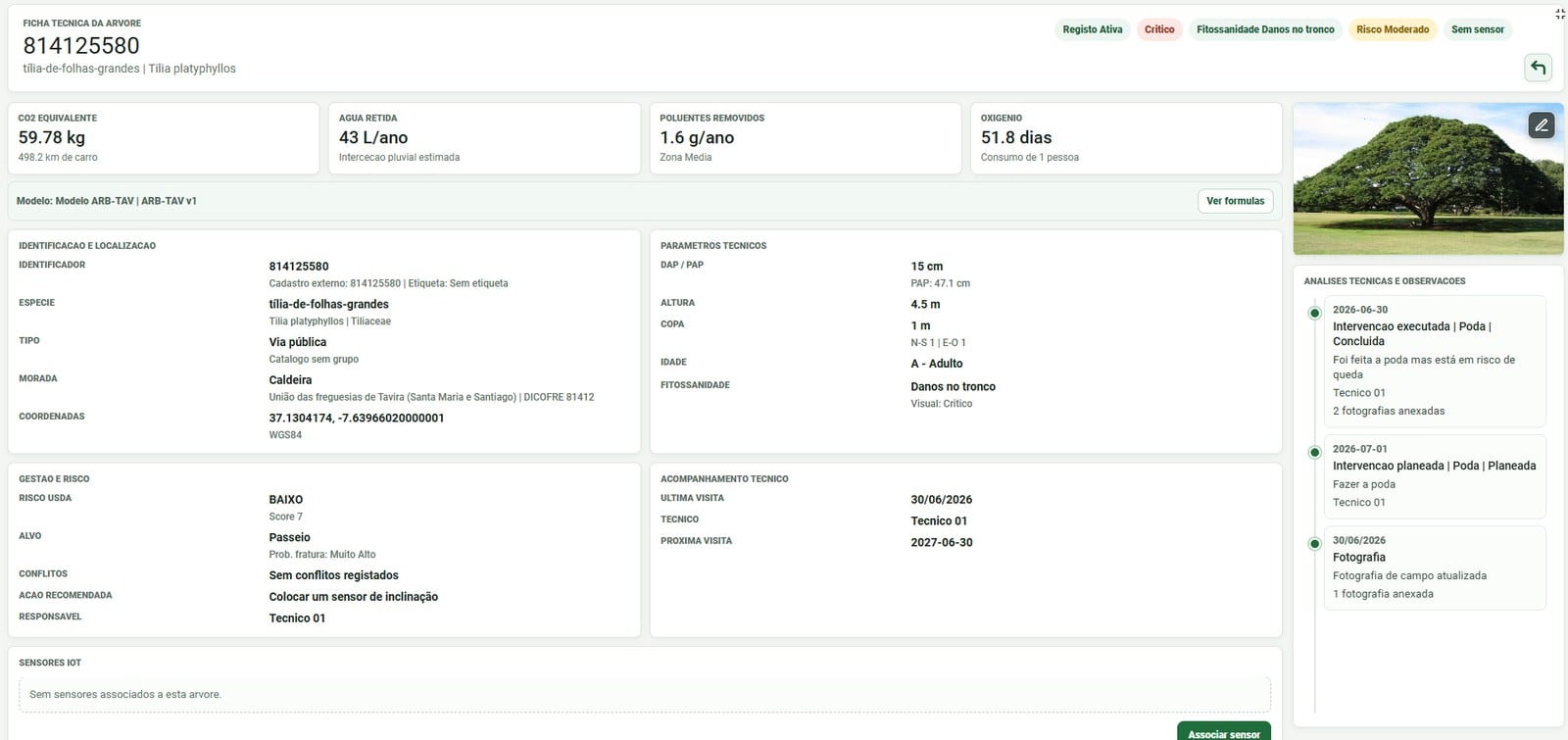
- Model each tree as a digital asset — identity, location, technical fields, operational status, history, and its relationships to sensors and interventions.
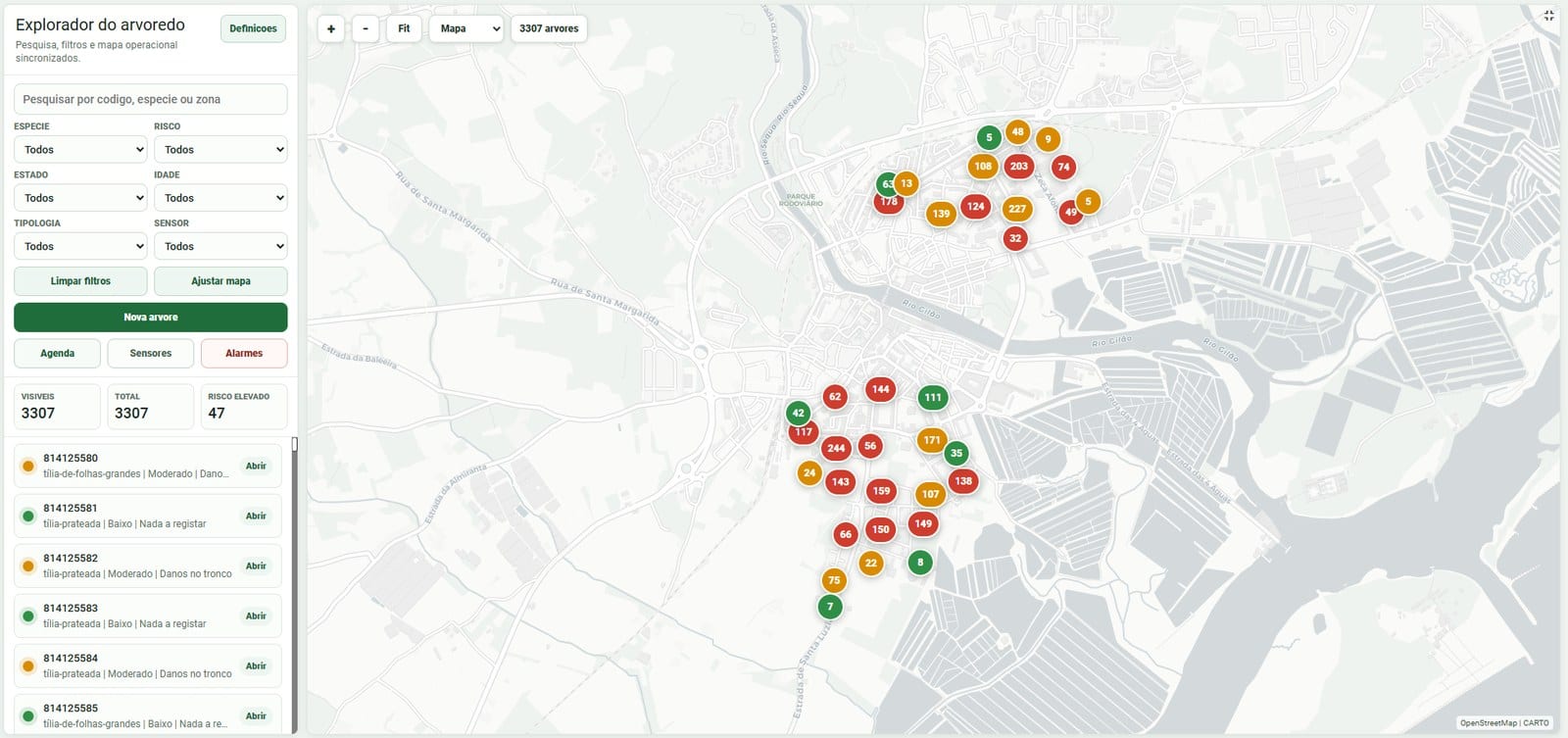
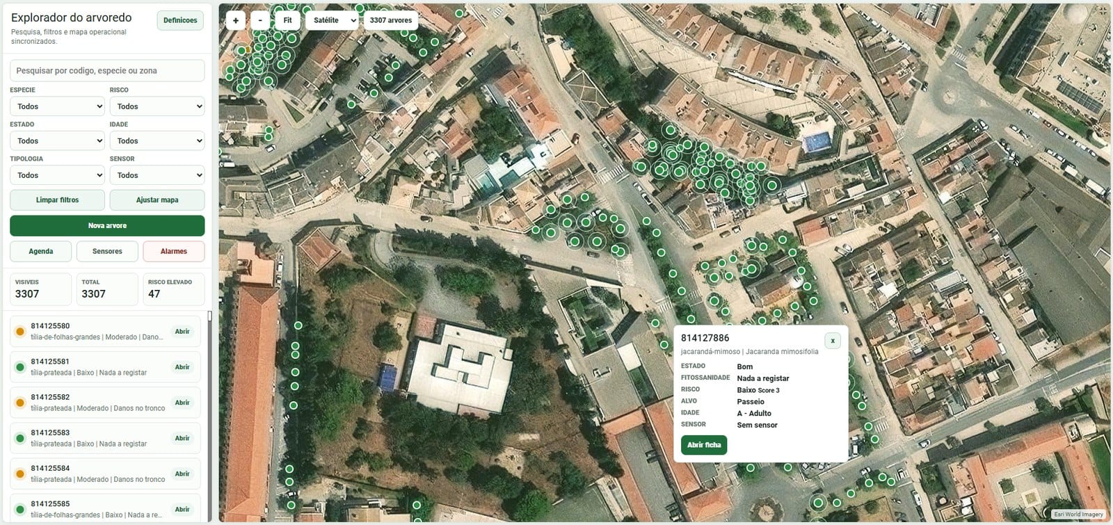
- Build an operational map, not a GIS replacement: search, filter, locate, prioritise, act.
- Selective IoT: LoRaWAN tilt sensors only on critical trees — near schools, roads and playgrounds, or with known instability — not on the whole stock.
- Configurable typologies, fields and permissions instead of hardcoding, so the vertical is reusable across municipalities.
- Translate legal requirements into product capabilities: inventory fields, a public layer, RJGAU-aligned intervention typologies, planned-intervention alerts and open-data-ready structures.
- Environmental indicators as a differentiator — CO₂ equivalent, retained water, pollutants removed and oxygen, per tree and aggregated.
- Human-in-the-loop: sensor data prioritises field verification; diagnoses and formal conclusions stay with technicians.
What shipped
A complete vertical, structured around five verbs — know, prioritise, monitor, act, report:
- Georeferenced inventory import (Shapefile, GeoPackage, GeoJSON, CSV, XLSX) with a digital record per tree
- A map-based tree explorer with search, filters and risk clusters
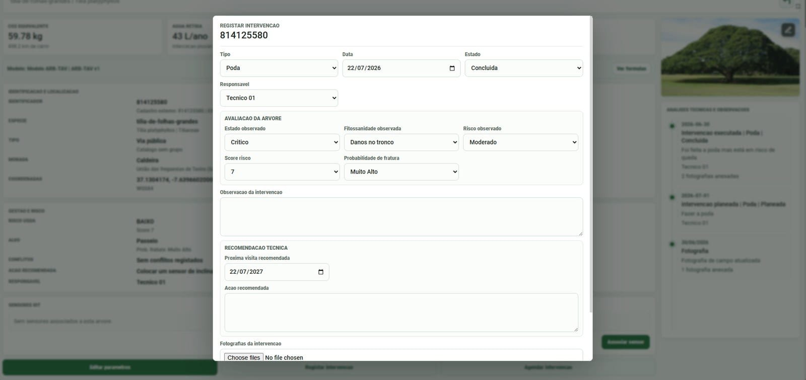
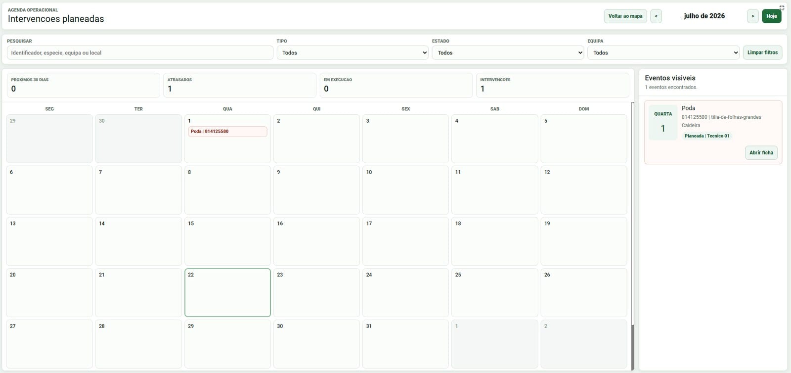
- RJGAU-aligned intervention workflows, scheduling, and alerts for planned interventions
- Batch operations and role-based permissions by team, parish, zone or tree group
- Environmental indicators at tree and aggregate level
- LoRaWAN tilt sensors on critical trees, with thresholds and alarms
- A mobile interface for field teams — records, photos, statuses and occurrences updated on site
- An optional citizen portal: public map, occurrence reporting, tree adoption and civic participation
- A modular three-year SaaS commercial structure
Evidence and outcomes
The product closes the full operational loop — detect, prioritise, assign, act, document — in a single digital record per tree.
For municipalities it delivers day-to-day operations, risk prioritisation, compliance support, data continuity, field efficiency, and a way to communicate the environmental value of the tree stock to citizens and decision-makers. The vertical was refined with real client and maintenance-team feedback.
Reflection
- A vertical is not just a dashboard — it needs data structure, workflows, permissions, operational states and clear users.
- Compliance can become product value: legal requirements guided feature definition instead of just constraining it.
- Scope discipline matters — separating what the platform does from what requires arborists and legal specialists.
- IoT is most valuable solving a specific operational problem: critical trees, not a generic technology layer.
- Configurable beats custom-coded when every municipality works differently.